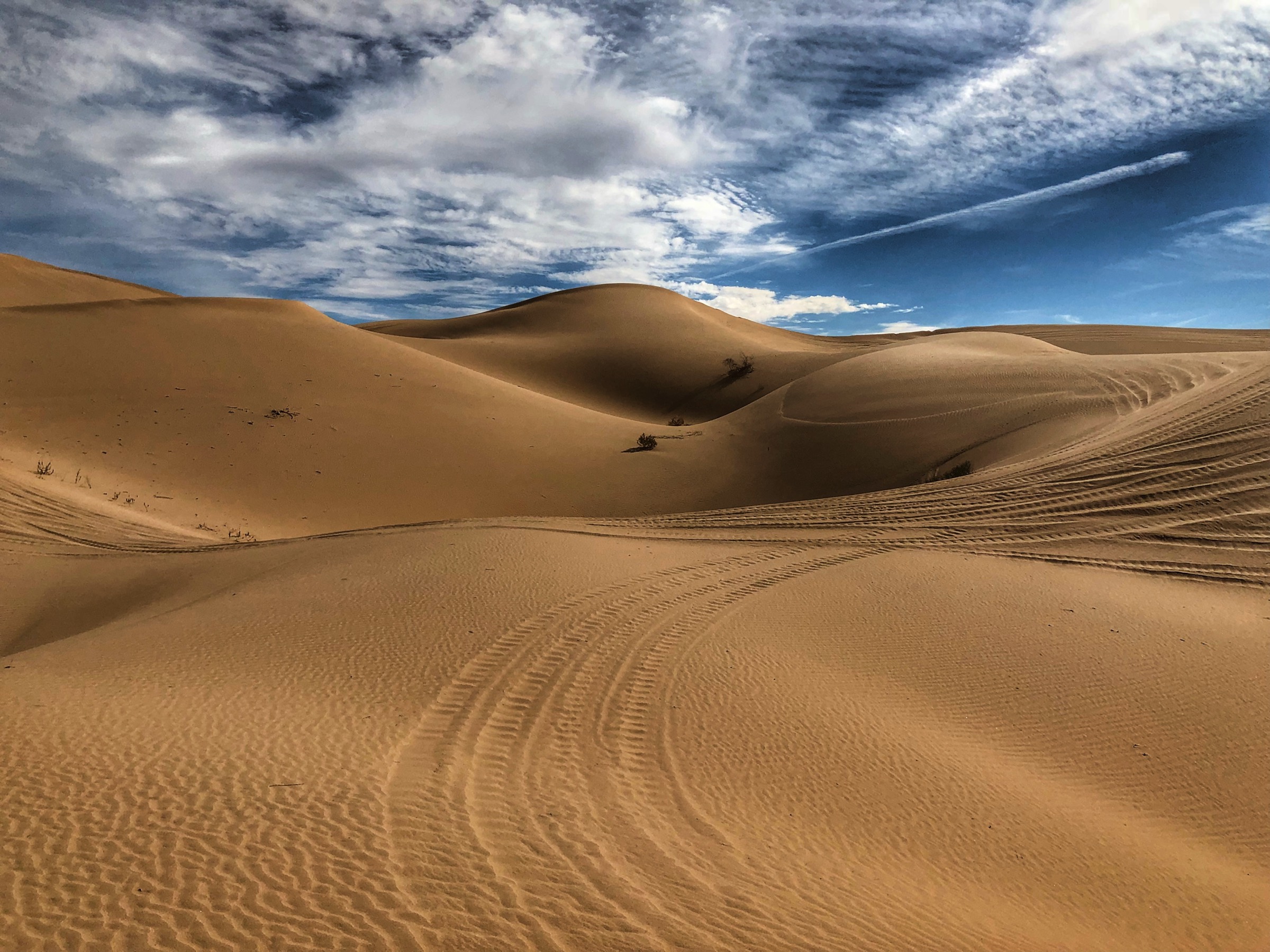
The dunes, in your pocket.
Glamis Map is the offline map of the Imperial Sand Dunes: every camp, hill, and landmark, working where cell service doesn't.
Built for the dunes
Fully offline
368 MB of aerial imagery on your phone. Zero bars required.
Every spot that matters
80+ camps, hills, washes, and landmarks, with photos, elevation, and the local story.
Collections
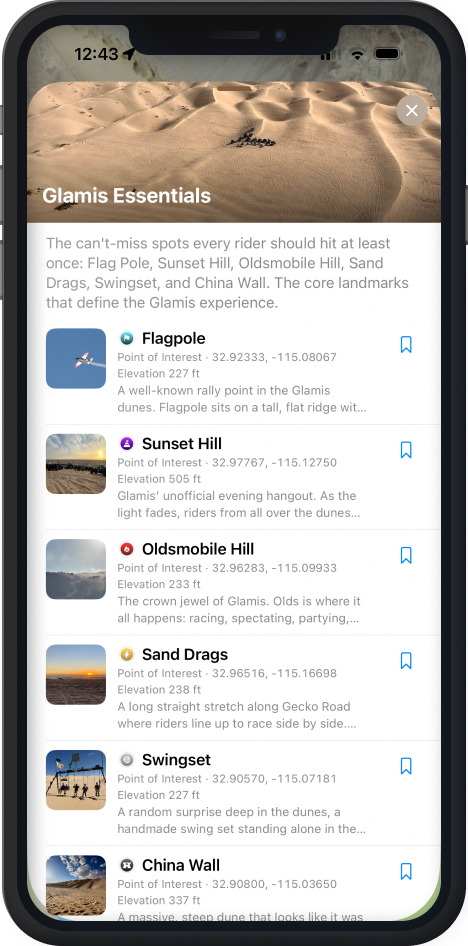
Curated sets like Glamis Essentials, the can't-miss spots every rider should hit once.
Find anything fast
Search the dunes. Filter camps, vendors, points of interest.
Save your spots
Bookmark camp and favorites; they're one tap away all weekend.
Native iPhone app
Not a website in a wrapper. Built with SwiftUI and MapKit for sunlight, gloves, and speed.
Point. Ride. Arrive.
No roads. No turns. Just a heading.
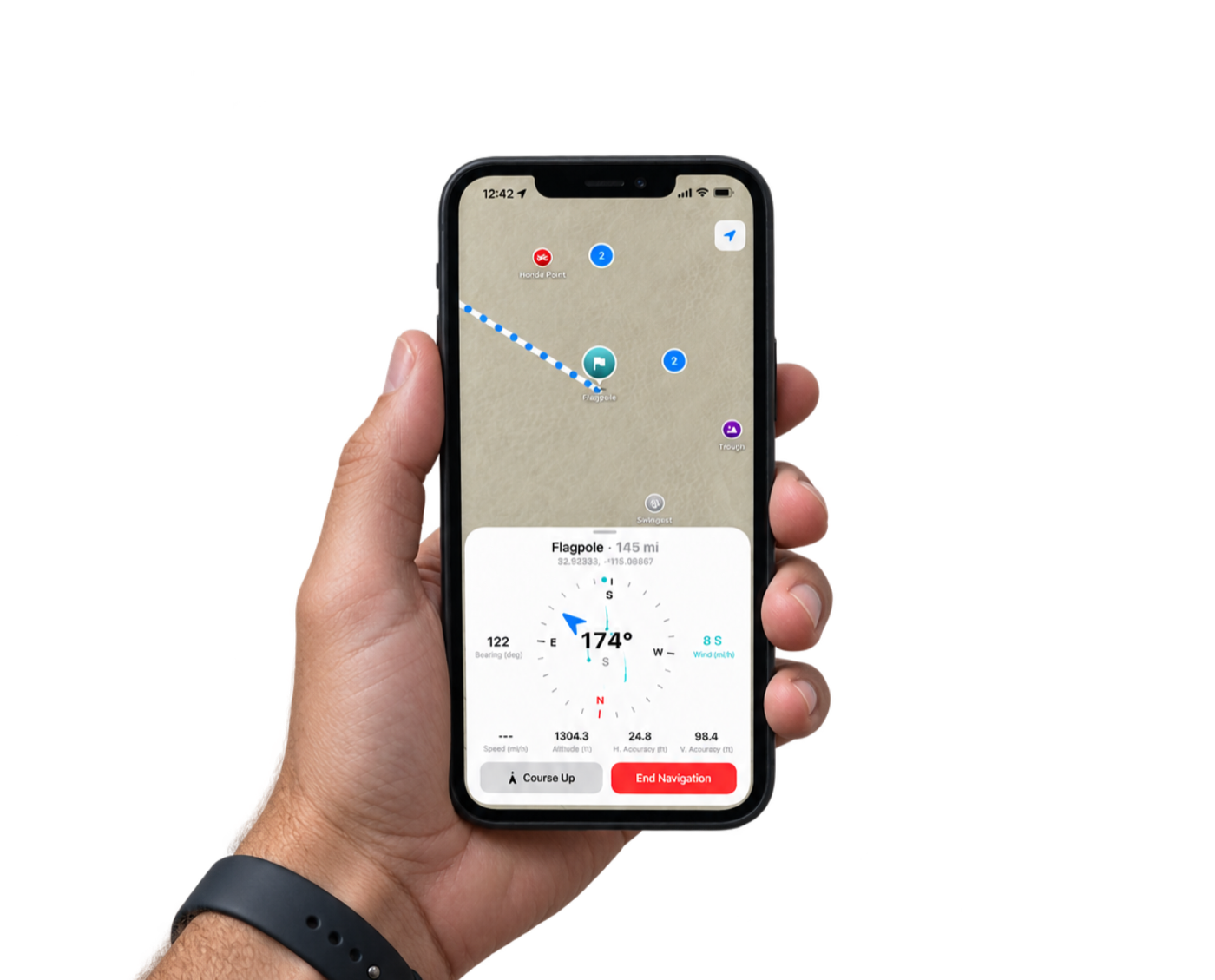
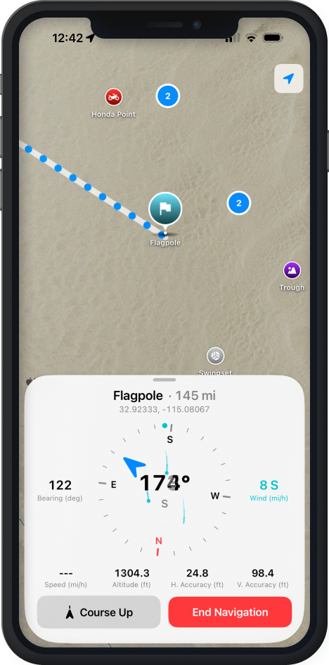
Pick any spot and Glamis Map draws a straight line to it: live distance, compass heading, and a heading tape under the banner. Out here there are no roads, so there are no turns. You always know exactly how far and which way.
- Live distance & bearing, updating as you ride
- Full compass card with live wind speed and direction
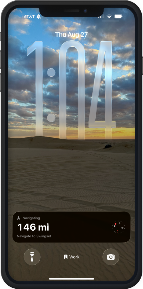
- Lock Screen Live Activity, glanceable without unlocking your phone
Directions on your Lock Screen.
A Live Activity keeps distance and bearing on the Lock Screen while you ride: no unlocking, no app-switching, glanceable in a phone mount.
Field guide, not a database
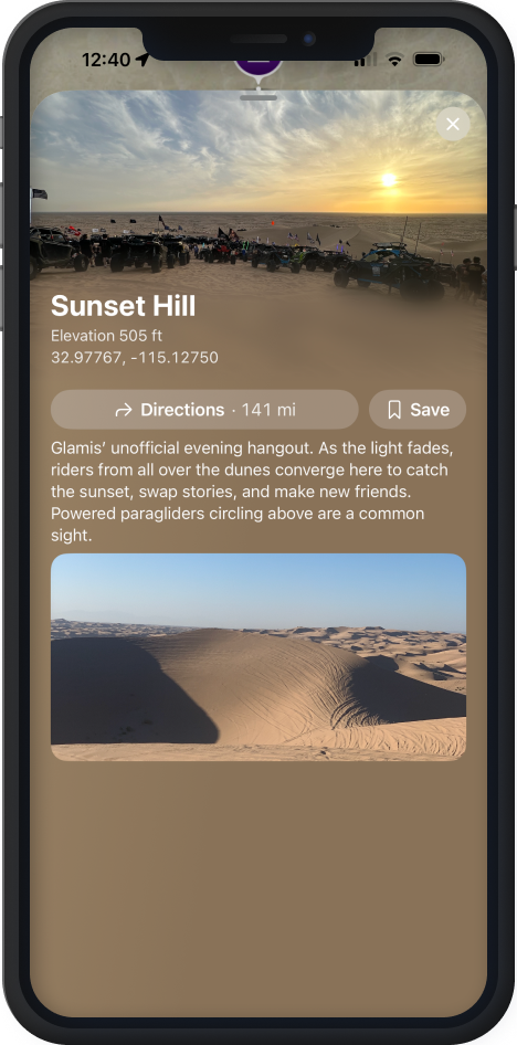
Every place tells its story.
Each location carries a custom symbol built for that place. Tap it and the card opens: a full-bleed photo, elevation, coordinates you can copy, and a description that covers Glamis today and Glamis history. No two cards look alike.
Everything, organized your way
One panel. Your dunes.
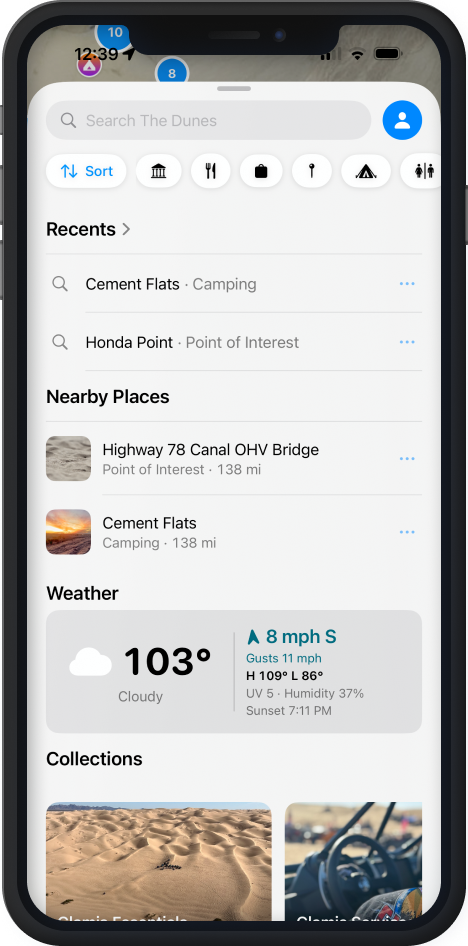
Browse every camp, hill, and landmark, or filter down to exactly what you need. Your saved spots, what's nearby, current weather, and curated collections, all in one place.
- Browse and filter all points of interest
- Recents and Nearby: what you just visited and what's close right now
- Current weather, on the dune
- Collections: Glamis Essentials and more
- Search the whole dune in a couple of characters
Hands stay on the bars
Just ask.
Gloves on, phone in a mount, no time to tap through menus. Glamis Map works with Siri for the moments that matter most.
“Hey Siri, show Oldsmobile Hill in Glamis Map”
Opens the location card directly
“Hey Siri, navigate to Sand Drags in Glamis Map”
Starts navigation, no unlocking required
“Hey Siri, end navigation in Glamis Map”
Ends the ride, hands never leave the bars
Why I built this
I've been riding Glamis for years, and every trip starts the same way: no signal and a vague idea of where camp is. I built Glamis Map so the whole dune (imagery, camps, landmarks) lives on your phone and works without a bar of service. It's the app I always wished I had out there.